Submitted by Tamzin Byrne on Tue, 21/03/2023 - 15:36
A phone app to measure tree trunks; machine learning to fight forest fires; and putting Belfast’s trees on the map: our researchers are combining insights from plant science with technologies from computer science to understand trees and forests in new ways.
Forests contain over half the global carbon stock in soils and vegetation (1), so forest protection and restoration is key to our work at 4C. And 820 million people live in and around forests, so forest health has a real impact on human lives.
For UN International Day of Forests, we’re celebrating the work of early-career researchers in our team who are already making a real-world impact by winning start-up competitions, publishing in high-impact journals, and sharing their work with the public at the Cambridge Festival.
1 Food and Agriculture Organization of the United Nations (FAO)
A phone app to measure the size of trees
Amelia Holcomb
The diameter of trees - the width of their trunks - helps ecologists to understand the health of an individual tree, the overall health of the forest and to make good estimates of the amount of carbon stored in the wood. But measuring trees by hand is time-consuming and prone to human error.
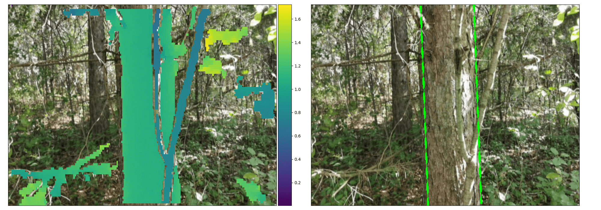
Amelia Holcomb, a PhD student in the Department of Computer Science, has developed a smartphone app which can estimate tree trunk diameter from a single photo, even in complex forest environments, using the laser sensor that is already in many modern smartphone cameras. The work was published recently in the journal Remote Sensing, with colleagues in Canada and Cambridge.
When tested in forests in the UK, USA and Canada, the app correctly detected 100% trees, with an average error rate of 8%, which is comparable to the level of human error. However, the app sped up the process significantly and was about four and a half times faster than measuring trees manually.
“I was surprised the app works as well as it does,” said Amelia. “Sometimes I like to challenge it with a particularly crowded bit of forest, or a particularly oddly-shaped tree, and I think there’s no way it will get it right, but it does.”
Other researchers have carried out some forest measurement studies using this type of sensor, however, this has been focused on highly-managed forests where trees are straight, evenly spaced and undergrowth is regularly cleared. Amelia and her colleagues wanted to develop an approach to use these sensors in non-managed forests, getting accurate results quickly for non-managed forests quickly, automatically, and in a single image.
Read more from the University of Cambridge
Read the paper: Amelia Holcomb, Linzhe Tong, and Srinivasan Keshav. ‘Robust Single-Image Tree Diameter Estimation with Mobile Phones.’ Remote Sensing (2023). DOI: 10.3390/rs15030772
Seeing the woods for the trees: mapping Belfast’s treescape
A ring of lime trees surrounds Belfast City Hall, and its parks are full of oaks, maples and pines. Meanwhile, in the less historically-wealthy parts of the city, trees are harder to find.
Belfast has committed to plant a million trees by 2035, and has made data about the location and health of trees publically available through the gov.uk open data platform. But a spreadsheet isn’t very inspiring, and makes it hard to consider the interplay between trees and the urban landscape.
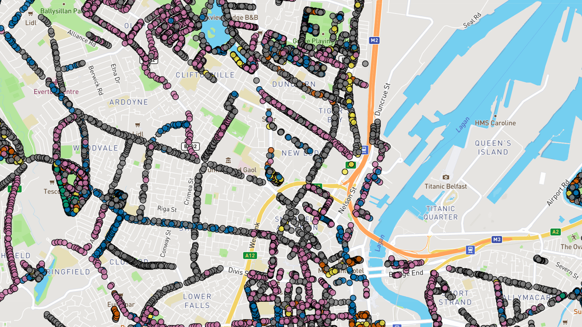
Instead, 4C research assistant Patrick Ferris has plotted all of Belfast’s trees on a map, showing at a glance where trees are found, as well as their species, age and condition. This makes it easy to see which areas are lacking access to green spaces, and sharply highlights the contrast between wooded, grassy and built urban areas.
At the recent Cambridge Science Festival, Patrick shared this work in a sold-out session at the University’s Department of Computer Science and Technology.
“Community engagement is essential for tree-planting and forest projection projects to succeed”, said Patrick.
This is part of a larger project Patrick’s running to map forests across Northern Ireland. Visualising this data helps to draw deeper conclusions about the nature of forests, helping us see at a glance the ecological difference between a rich, ancient broadleaf forest and a modern pine plantation.
Northern Ireland is one of the least wooded regions in Europe, according to the Woodland Trust’s manifesto for Northern Ireland, which was the inspiration for Patrick’s work. However, efforts to reforest often rely on imported trees, which put ancient forests at risk from pests and diseases. Patrick’s data visualisation makes it easier to see the mix of trees: a biodiverse broadleaf woodland is easily distinguished from a monocultural plantation of pine and spruce.
Explore NI Forests and Belfast Trees yourself.
FireSight: understanding the risks of wildfire anywhere in the world
Jovanna Knezevic and Onkar Gulati
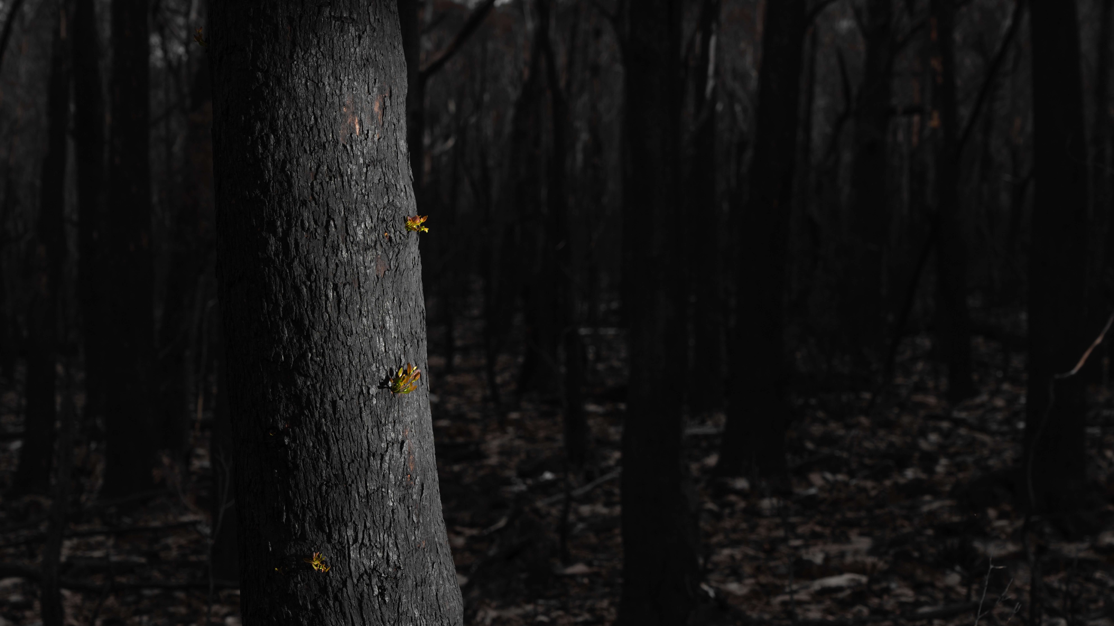
Forest fires of unprecedented scale have hit Australia, California, the Amazon and Southern Europe in recent years - and those are just the ones that we hear about. Wildfires disproportionately affect those in poverty and are just as prevalent in the Global South. But, most fire research is based in wealthy countries, using methods that aren’t easily comparable between regions.
Understanding fire risk on a global scale is the challenge taken up by 4C PhD students Jovana Knezevic and Onkar Gulati, whose start-up idea ‘FireSight’ recently won the Lucy Cavendish LucEnt Challenge, and was named runner up in the Cambridge Zero Climate Challenge.
Still at the concept stage, FireSight would use satellite remote sensing data analysed using machine learning to understand wildfire risk globally. This could give low-income countries affordable access to accurate information about fire risk, and could allow for coordinated regional strategies to prevent forest fires.
The climate impact of fire is about 1.8 gigatonnes of CO2 a year, equivalent to 6% of all emissions from human activity. Understanding the impact of fire on carbon emissions, but also the potential for ‘reversal’, or the loss of carbon storage in trees, is an important strand of 4C’s work.
Chris Gibbs from the university’s commercialisation arm Cambridge Enterprise said: “Helping build the entrepreneurial mindset in the University ecosystem is critical to the innovation agenda and particularly crucial for a true net zero where over half the innovations needed for 2050 are still in the lab.”
Read more about the FireSight team's recent successes:
Funders
Amelia Holcomb’s research was supported in part by the David Cheriton Graduate Scholarship, the Canadian National Research Council, and the Harding Distinguished Postgraduate Scholarship.
Onkar Gulati and Jovanna Knezevic’s PhD research is funded by a charitable donation from the Tezos Foundation through AI4ER (AI for the Study of Environmental Risk), part of the UKRI Centre for Doctoral Training in the University of Cambridge Department of Computer Science and Technology.


